Two Weeks in Kyushu, Part 2: Yakushima
Yakushima is a tropical, eternally-rainy island part of Kagoshima Prefecture. Planning at least three months in advance is highly recommended particularly during the high season, as it is somewhat popular among domestic tourists and availability of rental cars and accomodation is limited. Originally I only booked three days in Yakushima, but stretched it to five from some online advice I received—and I’m so glad I did, because this might be my favorite vacation spot in the world.
You can view a map which includes all the places I mention in this post here.
Day 3: Shiratani Unsuikyo and Inakahama Beach
Getting There
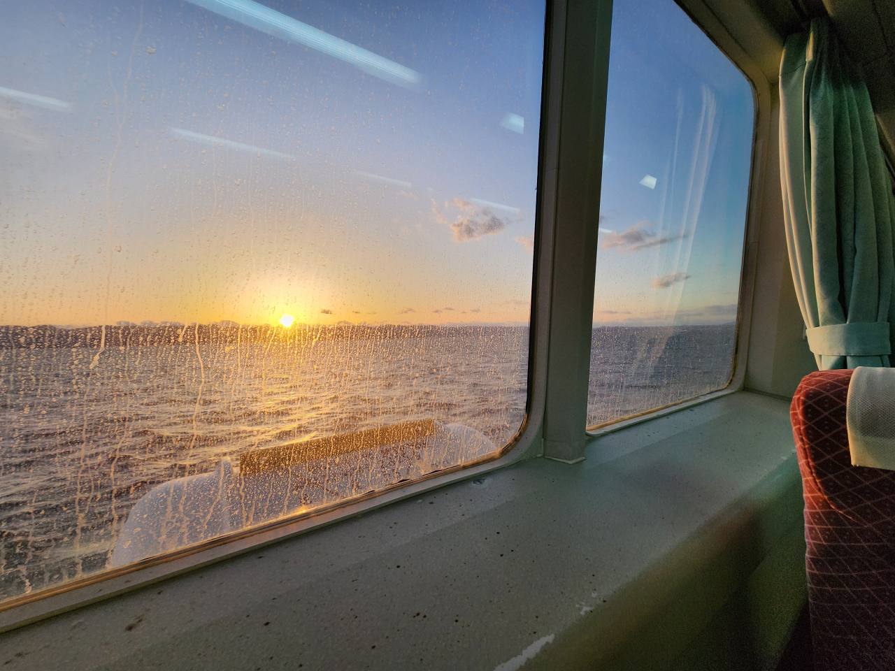
I booked a ride via Taneyaku Jetfoil, a high-speed hydrofoil service that operates between Kagoshima City and Yakushima. I boarded the first morning departure. The tickets can be reserved online in advance but must be exchanged for the physical ticket in person before departure.
As our craft headed south, the morning fog in Kagoshima Bay began to lift, and I saw many fishermen on their boats getting their morning catch in the calm morning waters. The boat stopped in the port town of Ibusuki before heading out to the rougher open seas. On the way I was even able to see active vents from Iojima.


Getting around Yakushima is possible by bus, but like many places in rural Japan, a rental car is the best option. I highly recommend against anything larger than a kei car on Yakushima as there are many very narrow roads. I booked online directly through Suzuki Rental Lease Yakushima, though those who can’t speak Japanese may be best served by booking through YES YAKUSHIMA. Once I arrived at the Miyanoura ferry terminal, they very kindly gave me a free ride to the car rental shop (make sure to request this in advance).
Before heading off to my first destination, I stopped by the Yakushima Environmental and Cultural Village Center. The staff here were friendly, and they, along with many others in Japan I had talked to, recommended the staple pilgrimage of any Yakushima hiker: the Jomon Sugi hike. I was hesitant given how difficult I heard the hike and the rainy weather forecast, but I purchased my bus tickets anyway before heading off to Shiratani Unsuikyo (白谷雲水峡). More on the Jomon Sugi hike in the next section.
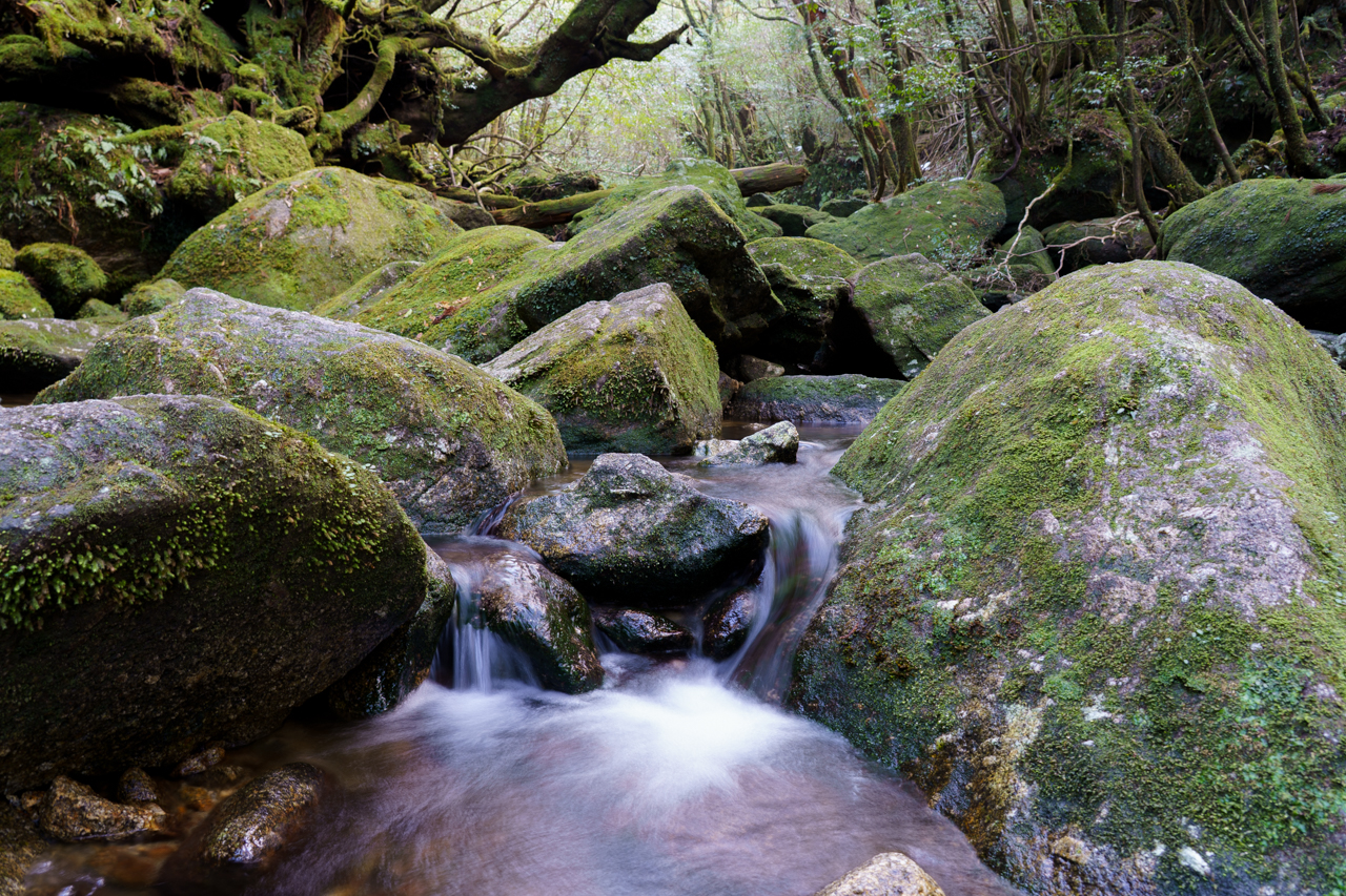
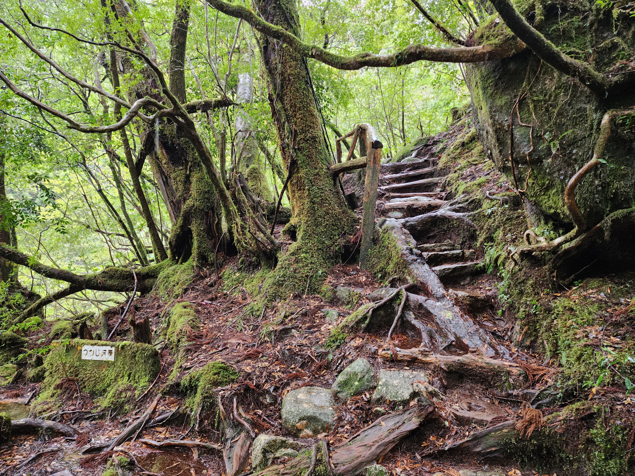
Shiratani Unsuikyo
The drive up the mountain roads on Yakushima are not for the faint of heart. I’d rate the road to Shiratani Unsuikyo a 3/5 in terms of driving difficulty. After a few kilometers of relaxed two-lane roads, it suddenly becomes a one lane road with a couple of sections lacking blind spot mirrors to look for cars around corners. And remember—buses drive up and down this road, so you may have to back up. This was complicated by the fact that my kei car didn’t have a backup camera… Fortunately the single lane portion ends fairly quickly and kindly leads into the parking lot with nearby bathroom facilities. Paying the 500 yen park fee grants admission plus a discount coupon for Yakusugi Land (save that for later!).
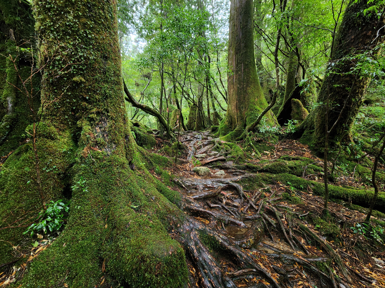
Since it was a sunny day with a balmy high of 22.4°C, I didn’t have to bring serious gear with me other than my trusty hiking boots, hiking bag, exercise clothes, and some snacks. The first 5 minutes or so of the hike feels like a regular forest walk, but this transitions quickly to mossy undergrowth with young and old cedar trees. It was especially nice to experience the gentle sun filtering through the leaves.
After a fair bit of hiking I finally arrived at the famous picture spot of Shiratani Unsuikyo that famously inspired scenes from the Ghibli film Princess Mononoke, the Moss Forest (苔むす森 Kokemusu Mori or もののけ森 Mononoke Mori).
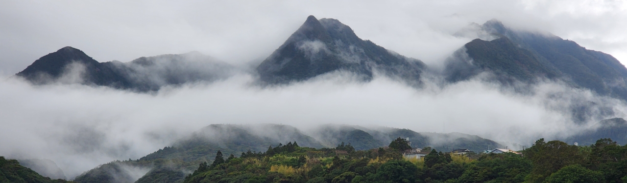
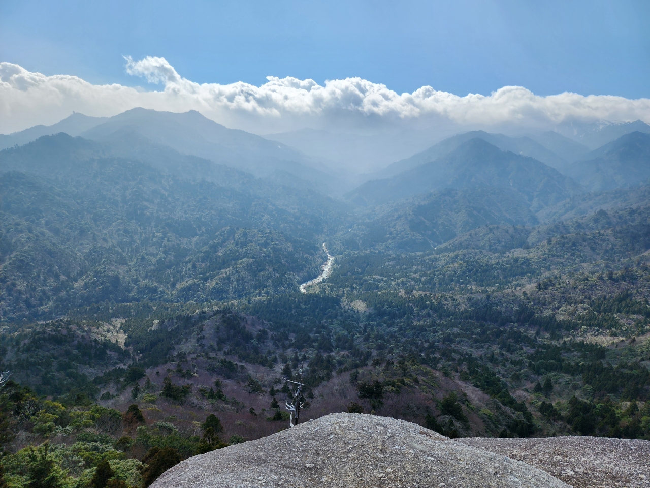
As I trekked further, I began to enter the more alpine climate of the island. Despite how far south the island is located, the higher altitudes do experience a fair amount of snow in the winter months. I was lucky that the snowpack had started melting by this point.


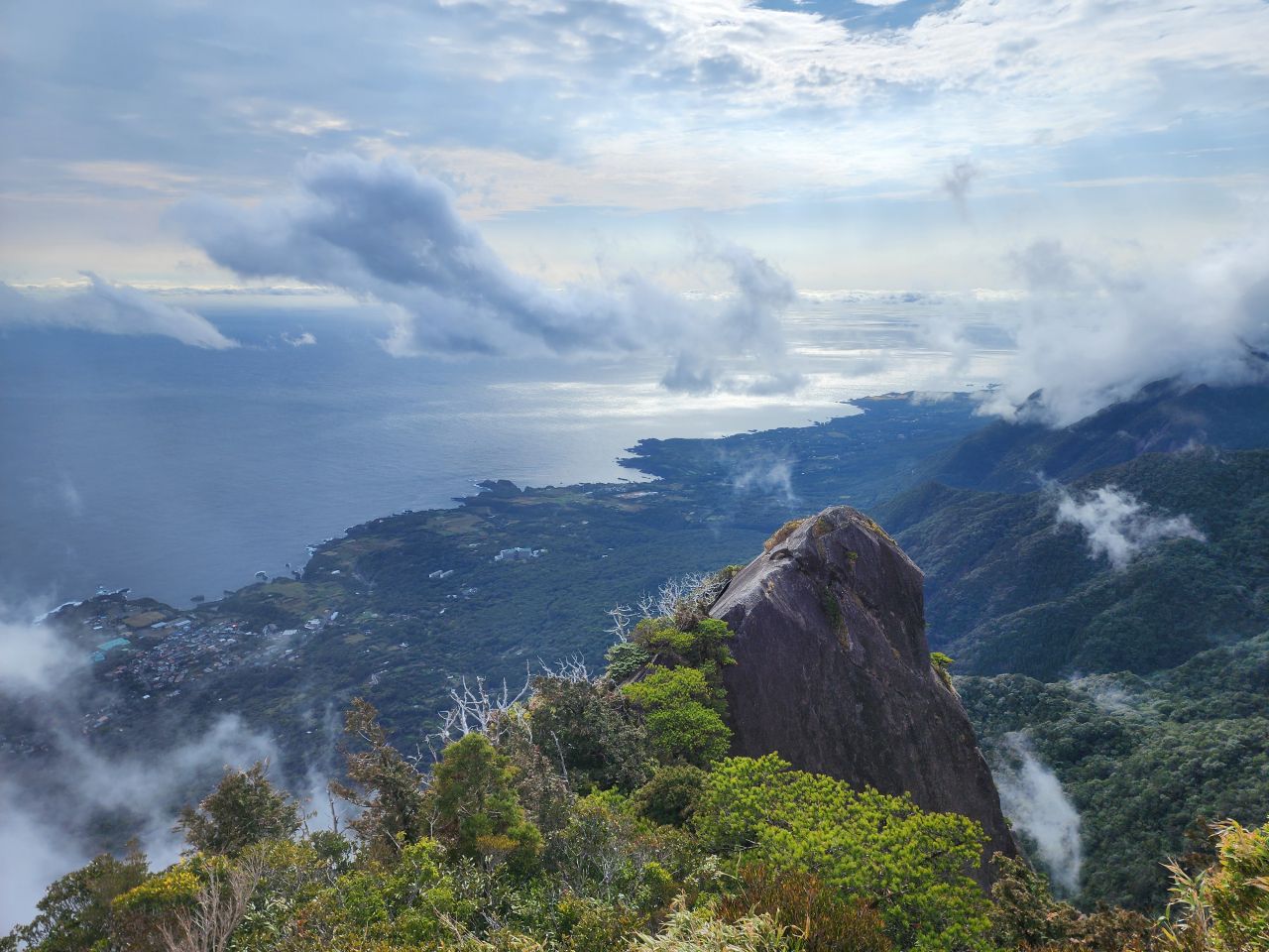
The last leg of the hike has the steepest elevation gain, particularly the small loop to arrive at the views from Taiko Iwa (太鼓岩). The views from the top give a wide vista over the treetops of the untouched forests as well as a glimpse of the inland mountain ranges, still covered in snow. In late March/April the gray-colored trees turn into blooming sakura throughout the valley.
The whole trip to and back took me around 3.5-4 hours, including a quick lunch break, which was quicker than I was expecting. I would definitely have gone a slower pace had I started earlier in the morning.
Inakahama Beach
Since I had some time on my hands and the forecast showed rain for the next few days, I decided to chase some sunset views. There are three places on the western coast of Yakushima that are particularly well known for this: the Eastern China Sea Observatory (東シナ海展望所), Yuhi no Oka Observatory (夕日の丘展望所), and Inakahama Beach (永田いなか浜).
The first two spots have nice picnic areas overlooking the steep coastline, but didn’t offer much entertainment before the sunset, so I set off for Inakahama Beach instead. This place is particularly famous as a nesting ground for sea turtles in the summer months and parts of the beach get roped off for this.
There were only maybe 3-4 other people on the entire beach while I was here. I took my time here to relax and watch the sunset.


Lodging
After a quick stop at the local A-Coop grocery store, I drove halfway around the island eastward to get to my accommodation in Anbo, the second-largest town. I recommend staying in this area as aside from Shiratani Unsuikyo, many of the roads leading to starting points for the amazing hikes are located on this side of the island. In fact, the Taneyaku Jetfoil does have a ferry which stops in Anbo, and there are quite a few rental car companies here as well.
I stayed in a secret gem, Suginosato (杉の里). This is a minshuku (民宿), not dissimilar to a bed and breakfast. Like a ryokan, the rooms are Japanese-style, but the entire operation is much smaller and homelier in scale. Although difficult to book if you don’t speak Japanese, this place was one of my favorite places to stay.
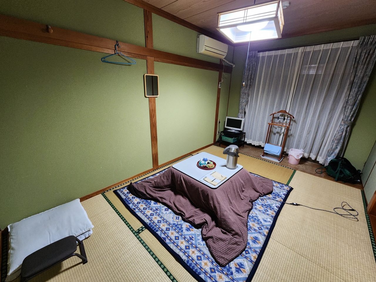
I recommend opting for the dinner meal plan as they use incredibly fresh ingredients every day in a full course meal, ranging from soups to side dishes to mains to dessert to even home-made tropical fruit wines (like guava wine!). One of the innkeepers would go out of their way to tell me about each of the dishes in depth. I wish I had taken notes on everything that they mentioned! The most notable of dishes was the kubiore saba (首折れサバ), which is mackerel that is quickly beheaded, bloodlet, and stored in ice so that it preserves its freshness and can be eaten raw. Mackerel is not usually eaten raw in other parts of Japan as it has a high rate of anisakis parasitism. To be honest I don’t think the odds of getting anisakiasis are any less with kubiore saba, but it was definitely delicious.


In their dining area, I was able to meet a couple of folks working in the timber industry as well as a university student named Shion from Osaka. Given the relatively low pricepoint of minshuku, the other travelers came from a wide range of ages and backgrounds. Staying in a minshuku was a great way to meet and chat with people especially as I was doing a lot of solo traveling.
Over dinner I pondered more about the Jomon Sugi hike. I had dreamed of climbing up Mt. Miyanoura, the island and Kyushu’s tallest point, but given a snowstorm had passed through not even two weeks ago (a fact that I could see from Taiko Iwa), and that the forecast for the next few days would be relatively rainy, I decided to opt for the well-trekked Jomon Sugi hike instead.
Day 4: Jomon Sugi Hike
The following day I woke up at a deathly 3:30 AM, where the thought of quitting the hike altogether briefly crossed my mind. The Jomon Sugi (縄文杉) is named as such because the cedar (sugi) is old enough to be from the Jomon period. The pilgrimage to this tree takes anywhere between 6-10 hours round trip for most people from the Arakawa trail entrance (荒川登山口), so starting early is very important to get back before dark. It is possible to converge with the trail to the Jomon Sugi from Shiratani Unsuikyo as it is only a little further from Taiko Iwa. (Had I been able to arrive in Yakushima in the early morning, I may have opted for this instead.)
The bus ticket is important as from March through November, the parking lot at the Arakawa trail entrance is not open to private vehicles, so the trailhead can only be accessed by bus. This ticket can only be purchased in-person at a select number of places on the island, and it’s recommended to buy a ticket at least one day in advance. The ticket costs 2000 yen round trip plus a 1000 yen conservation fee which helps pay for services like maintaining trails, toilets, and safety.
After getting a bearing of my senses I got my gear ready. It is extremely important to have proper equipment ready for the rainy climate of Yakushima in advance; I don’t regret overpacking or over-purchasing any of the hiking-related equipment I brought. In addition to travel medical insurance, which is super cheap for young travelers, my gear consisted of the following:
- A good hiking bag with waterproof cover
- Hiking boots, preferably water-resistant
- Rain coat
- Quick-dry workout shirt
- Long-sleeve hiking pants
- Hiking socks
- Umbrella
- Head lamp
- Water bottle
- Emergency portable water filtration system
- Breakfast and lunch bento that I ordered through my minshuku
- Gummi snacks
- Plastic bags for trash
- Phone pre-loaded with offline maps of Yakushima through Yamap, plus a backup phone
- Portable phone charger
I left at a healthy 4:30 AM to catch the earliest bus which leaves at 5:00 AM from the bus stop near the Yakusugi Museum. Getting there early ensures you can get on the first bus and avoid getting stuck behind later crowds and buses.
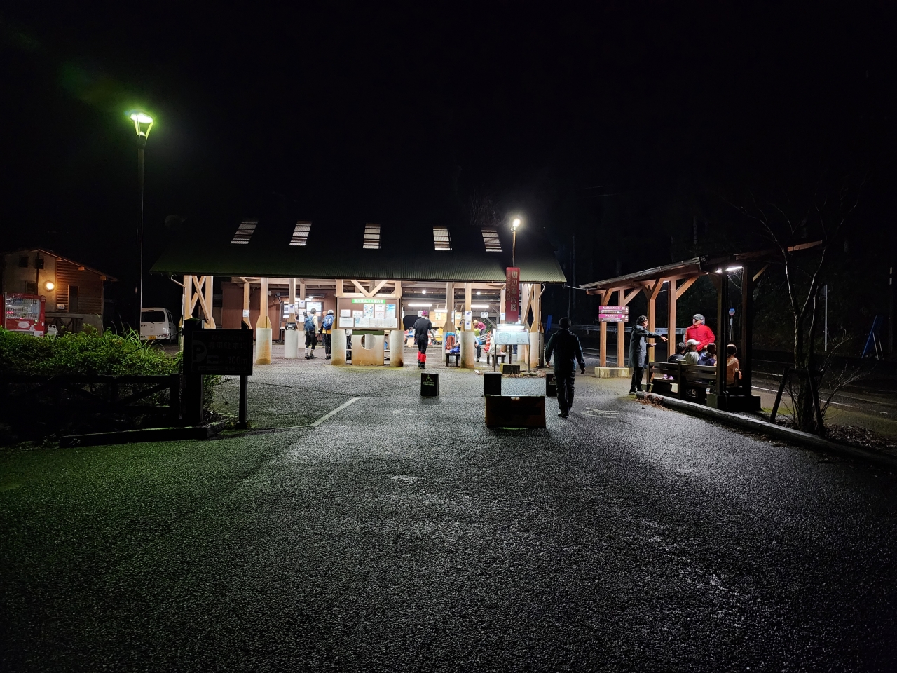
The bus arrived at around 5:30 AM to the trail entrance. At this time it was still absolutely pitch black. The rest stop was teeming with people using the toilet (which I made a point to do beforehand…) and eating breakfast. Maybe this is a thing with Japanese innately wanting to move in unison, but nobody else seemed to head toward the trail entrance. After blindly asking other hikers where the entrance was (they obviously didn’t know where it was either), I turned my head lamp on and pressed forward alone in the darkness.
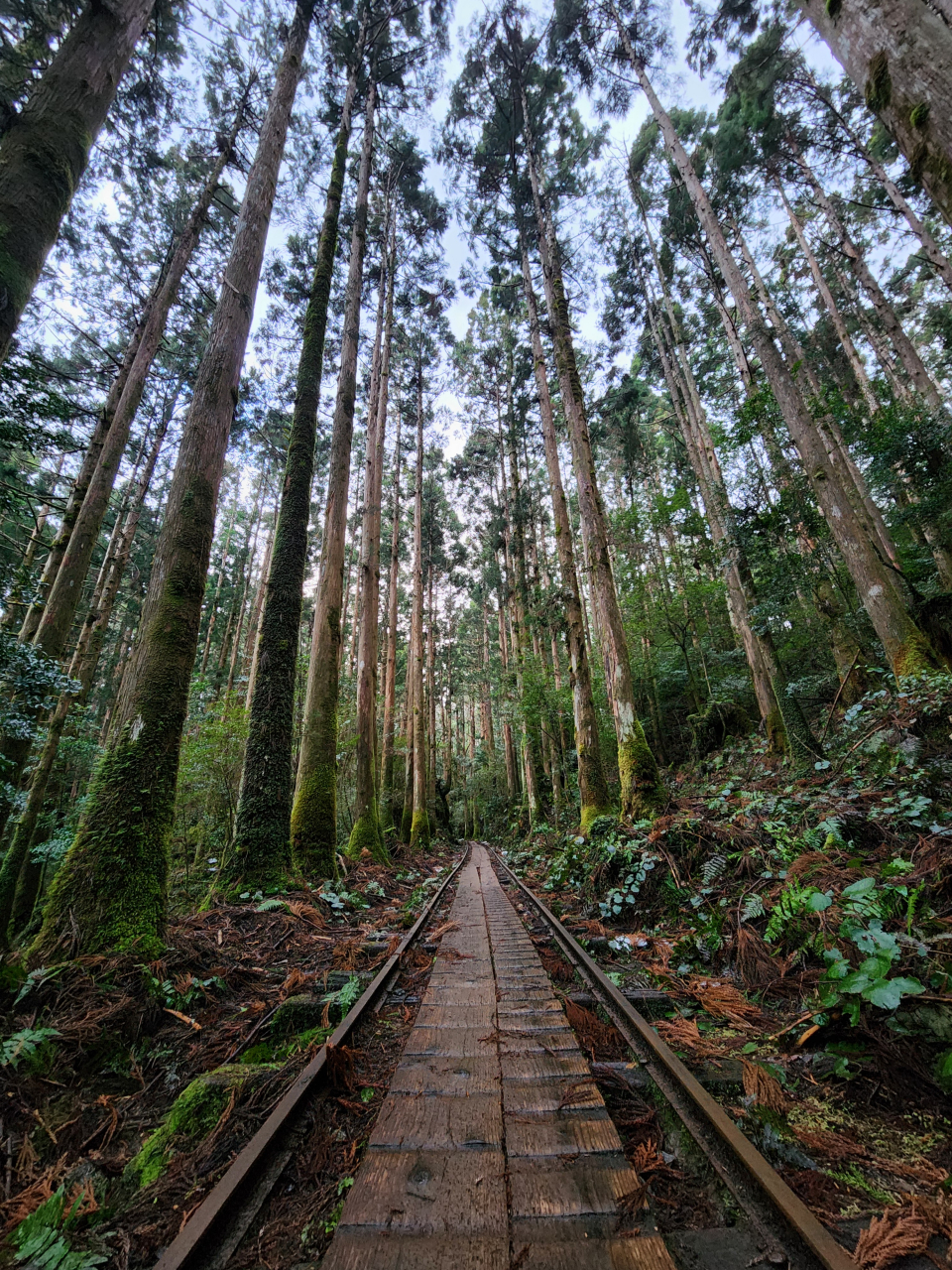
To be honest the first part was a little frightening. There was no sign of anybody in front of or behind me, so all I could do was trudge along while thinking about if a bear were to attack me (note: there are no bears on Yakushima). The trail follows an old railroad track which was used for settlements and logging. The worst part was crossing gorges and rivers; all I could hear was roaring water and see darkness between the aging wooden slats under me.
Thankfully at some point I got passed by two hikers going at a fairly brisk pace. (More on these two people later.) The muted morning light started to shine through the dense cloud cover, and I could see more of the mossy trees around me.
Since I was no longer worried about bears chasing after me, I could better appreciate the ancient cedar forests around me. The rain at this point was only a very light drizzle, and walking along the wooden path in this tropical rainforest was very comfortable.
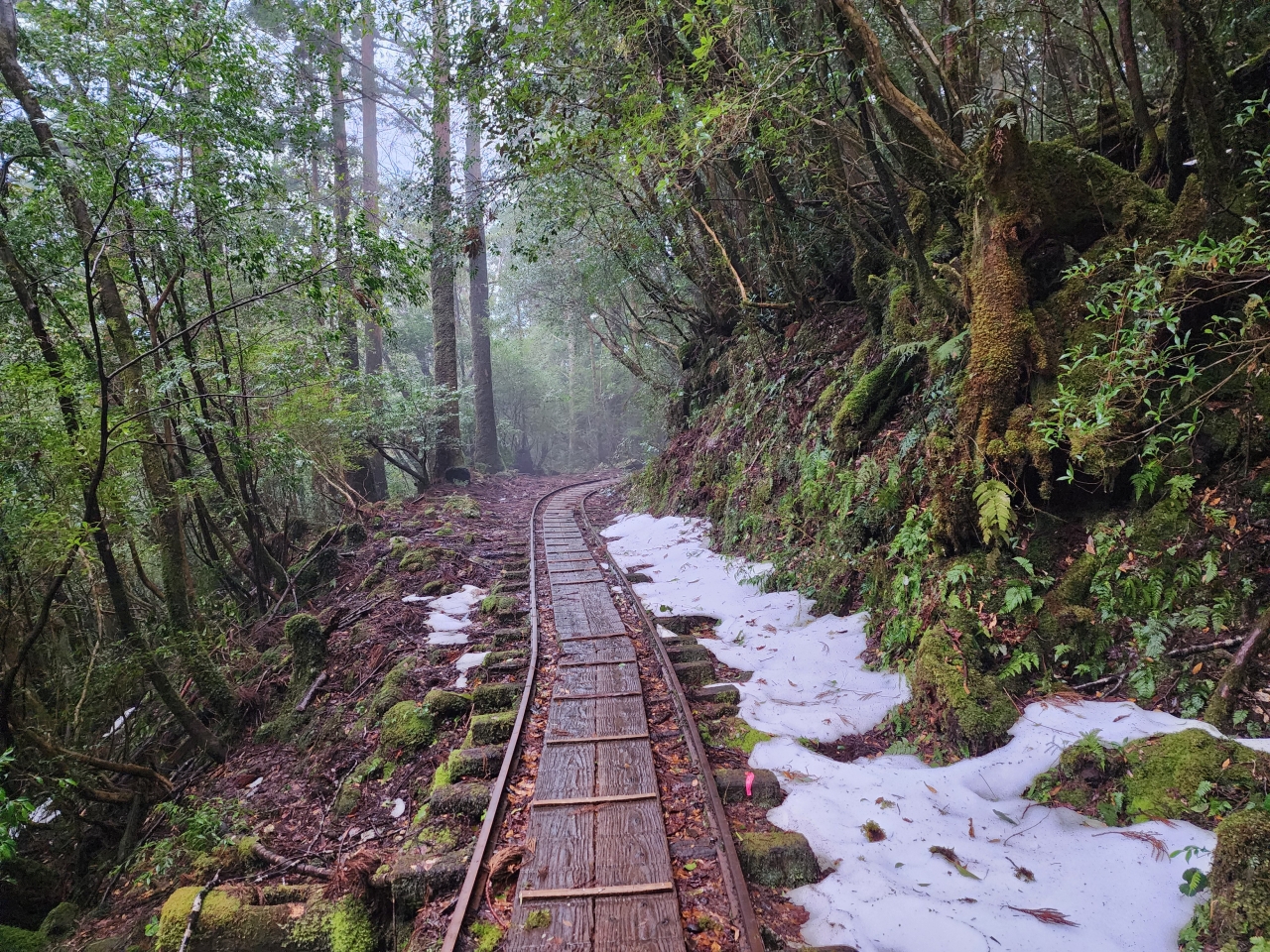
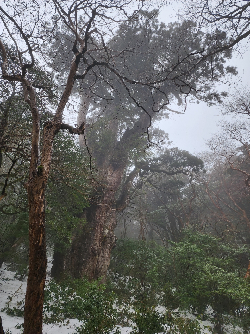
As I ascended higher into alpine altitudes, once again the tropical rainforest feel was juxtaposed by the sight of snow.
The first two hours of the hike were quite leisurely as it is primarily composed of a gently sloping railroad track. The real battle begins at the Okabu Trail Entrance (大株歩道入口), which is the gateway into the undisturbed growth on the island. There is a bathroom stop here. At this point I met with the two guys who had passed me earlier. One of them, Dr. Hiroaki Okui, was a vetinarian ophthalmologist! He graciously took a couple of photos for me.
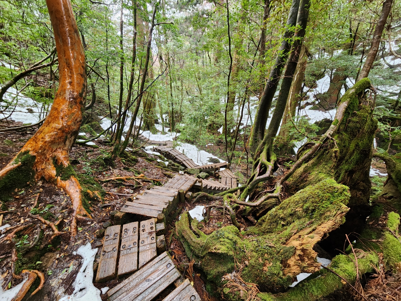
The Okabu Trail is has more difficult terrain and elevation gain than the railroad tracks from earlier. The terrain consists of rockier terrain interspaced with well-maintained boardwalks.
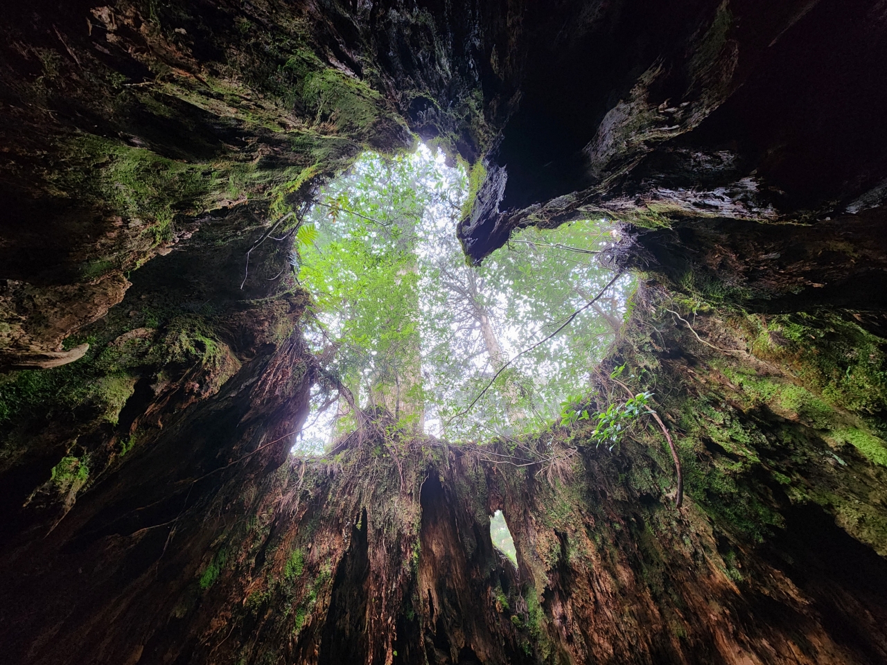
Only about 15-20 minutes after starting this portion of the trail, I reached Wilson’s Stump (ウイルソン株), an impressively large hallowed stump of a cedar tree. It’s hard to imagine how large the cedar tree occupying this space was. The real treat is inside the stump, when you look upward from a certain angle…
It’s a heart!
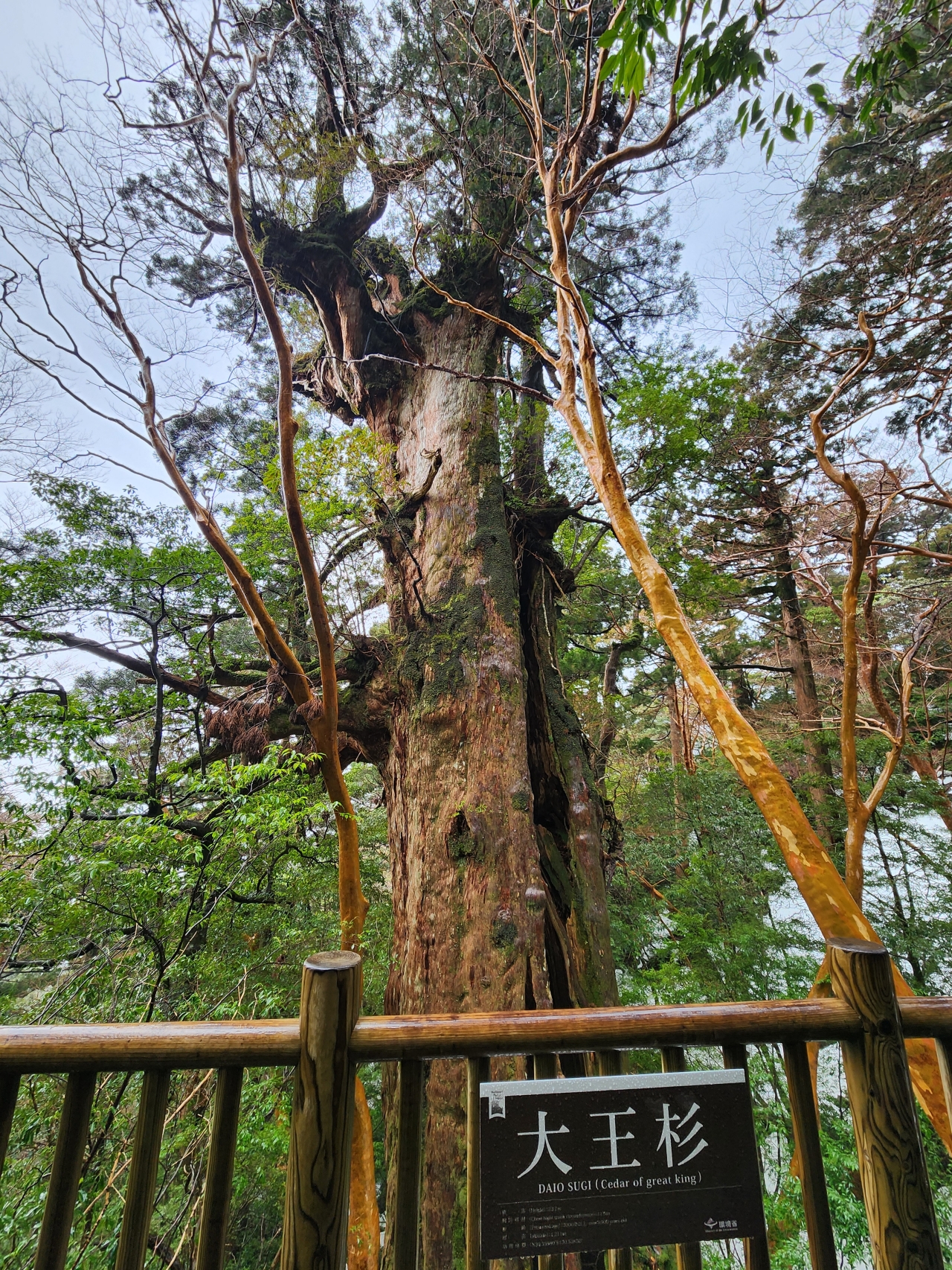
I should mention that there are a couple of yakusugi, a term used to describe particularly long-lived cedars (usually >1000 years old), that are encountered before getting to the Jomon Sugi. First is the Nioh Sugi (仁王杉), encountered before the trailhead of the Okabu Trail. After Wilson’s Stump there is the Daioh Sugi (大王杉, lit. great king cedar) which apparently there used to be a trail going down through the tree itself. This has been replaced by a platform, but it’s still an impressive tree to see.
At this point in my hike the rain and wind began to pick up. I was very glad to have my raincoat and umbrella, as there no good place to take cover. The path was covered in puddles and thicker patches of snow, and since I was still trying to be careful as to not make my shoes soaking wet, this slowed my progress quite a bit. I did meet a couple from Australia who soaked through their hiking outfits and only pair of tennis shoes; I was happy that wasn’t my situation!
At last, I arrived at the Jomon Sugi itself. The tree is massive, and although it can only be seen from a distance, the old growth of this tree really makes you ponder about the insignificance of everyday life compared to the lifespan of one of these trees.
Due to its hollow central core, it’s difficult to determine an exact age estimate of this tree, but it may be anywhere between 2000 and 7000 years old.
With the intensifying rain I didn’t really feel like going further along the trail (which does eventually reach the summit of Mt. Miyanoura). Some hikers returning from that direction said that the paths to the nearby Takatsuka Hut were completely covered in snow, so there was no stopping to eat lunch either.
Instead I took my time heading back and enjoyed the views of the ancient forest once again. Despite the weather, the rain accentuated the green in the moss and leaves, and it was still an enjoyable return hike. I was able to meet up with my hiking buddies near the end and get some commemorative photos. The entire hike with breaks took approximately 8 hours long. I later heard from the innkeepers that our expeditions were one of the first to reach the Jomon Sugi this year, as during the week before there was too much snow to safely access the area.


As I still had some daylight left in my hike, I stopped by the nearby Yakusugi Museum, which was actually quite interesting. It offered some great background info on the biology and lifecycle of the yakusugi and other island flora, as well as the relationship between human settlers and the trees. Note that English translations of the content here is limited.
At this point it was only around 4:30 PM but I was pretty exhausted from the long hike. I snapped a cool pic before heading back to the minshuku.
Day 5: Yakusugi Land and Waterfalls
I needed a rest day from all the hiking that I did on the previous day, as my legs were extremely sore. The weather was even more rainy this day, and so I chose locations that would be easy to get to by car without much hiking. I chose to drive up to Yakusugi Land (ヤクスギランド) to have a nice relaxing walk in some more old forest growth.
Yakusugi Land
The road up to Yakusugi Land gets a 4/5 difficulty rating from me. It converts into a single lane road relatively early along the route, and there is a decent amount of road traffic from other tourists and buses that take the roads up. The road is also fairly long. I had to back up several times and allow large construction trucks and buses to pass by to get up the mountain, which was frightening to say the least.
Although I arrived shortly after 9 AM, there was basically nobody else here, and I had the entire park to myself. Remember the coupon from Shiratani Unsuikyo? There are several walking courses; I chose the Tsutsujikawara Course (marked in blue on the map) which is approximately 2 km in length. The longer courses were apparently snowed in, and with my tired feet and the extremely rainy weather, I didn’t feel like going for the longer courses.


In addition to a large selection of yakusugi, the paths are well-paved and the park also has fun wire bridges which are much sturdier than the old bridges on the Jomon Sugi hike. The bridges cross sections of rivers which were quite swollen from the heavy rains.
Contrary to the popular Jomon Sugi hike, I was the only hiker around for many tracts of this park, so I could take my time walking around in my sore feet.
Overall I feel like this is a much safer place for family members of all ages. As I was leaving the park I even saw groups of school children. Lucky them!
Just a few minutes’ drive further up the road is another large tree, the Kigen Sugi (紀元杉), one of the oldest yakusugi on Yakushima. Kigen means “epoch,” which is certainly fitting as its estimated to be about 3000 years old.


Parts of the base of the tree are smooth, probably degraded from the oils and compounds present on human hands.
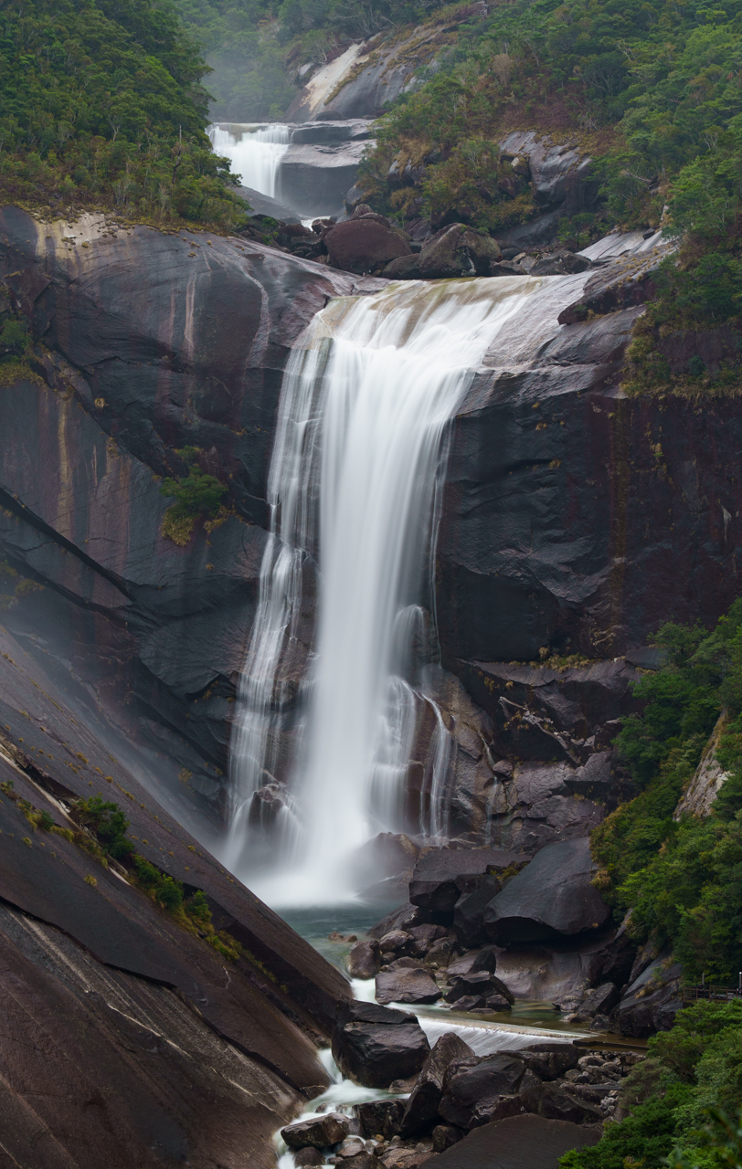
Ohko Falls
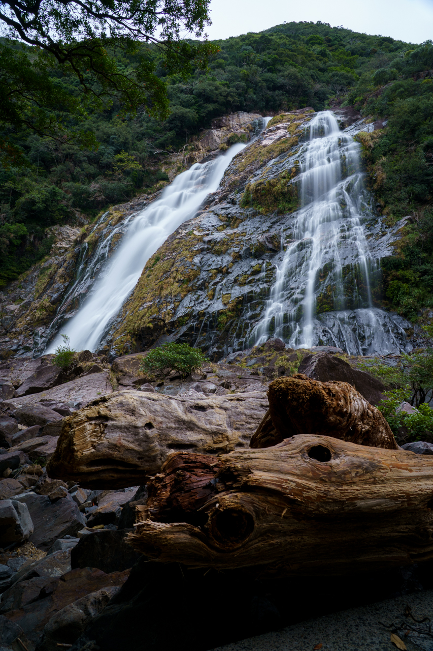
After eating my boxed lunch, I decided to travel further westward toward Ohko Falls (大川の滝). This is one of the most impressive waterfalls on the island, especially because you can get quite close to it. It reminds me a lot of Dynjandi in Iceland.
There are a bank of rocks at the foot of the waterfall which can be climbed up (careful not to slip). Luckily I had some waterproof pants and my waterproof jacket on, so I could stand close without getting drenched by the mist.
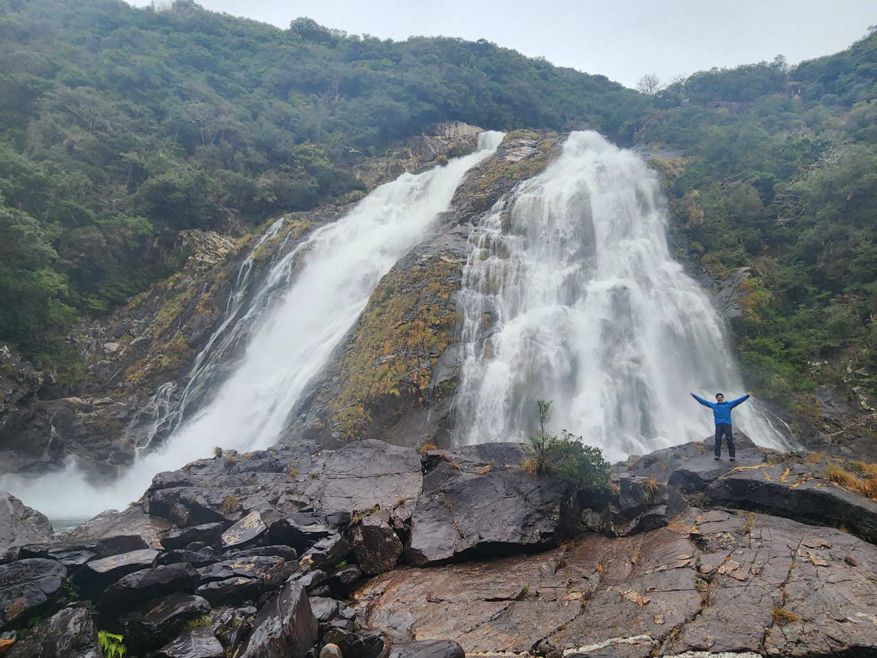
Another story (or rather, warning) from the innkeeper: one time it rained so hard that the entire viewing area under the waterfall was flooded to the top of the bank of rocks that I’m standing on in the image above. I can’t imagine how much water and rain poured down to make that happen.
On my way back home I visited the Tsukasaki Tidal Pools (塚崎タイドプール). I’m not sure if it was because of the time of day or tides, but this was unfortunately a bit of a let-down. Not only could I not see very much in the tidepools (which were also kind of dangerous to walk around even in my hiking boots), but also the beach itself was quite polluted.
I spent the rest of the day visiting two other waterfalls, Senpiro Falls (千尋の滝) and Ryuujin Falls (竜神の滝). While Ryuujin Falls is mostly obscured, Senpiro Falls is definitely worth visiting from its viewpoints. More on that one in the next day’s subsection below. Unfortunately on this rest day I didn’t bring my ND filters for proper long exposures, and had quite the difficulty getting nice long exposure photos. Luckily, this was excellent experience for when I came back on the following days…
Day 6: Mt. Mocchomu and Waterfalls
The following day I woke up with my feet feeling slightly refreshed, itching to do another hike. One that I had set my eyes on before getting to Yakushima was Mt. Mocchomu (モッチョム岳). Despite a steep and rapid incline (3000 ft elevation gain over 1.75 miles), the mountain treats hikers with stunning views of the Yakushima coastline.
Unfortunately, I woke up to a cloudy sky, although the forecast did show the weather would clear by late afternoon. I decided to take a chance on this forecast and killed my time in the morning with some closeby sights. I went first to the Sarukawa Banyan Tree (猿川ガジュマル), one of many banyan trees on the island. These trees can spread indefinitely by dropping aerial roots from their branches, which creates their sprawling appearance. Worth the 5 minute detour but not much more than that.
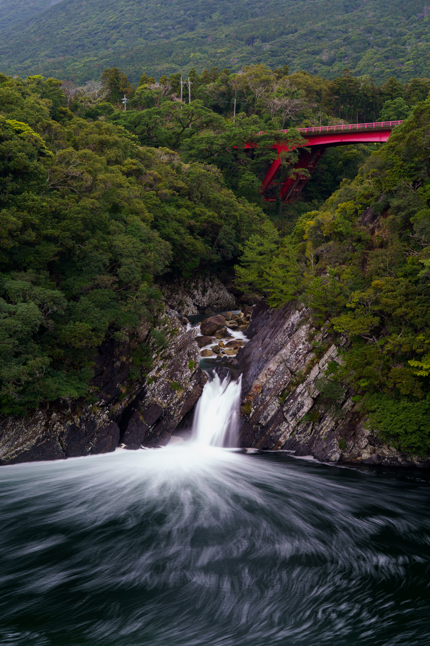
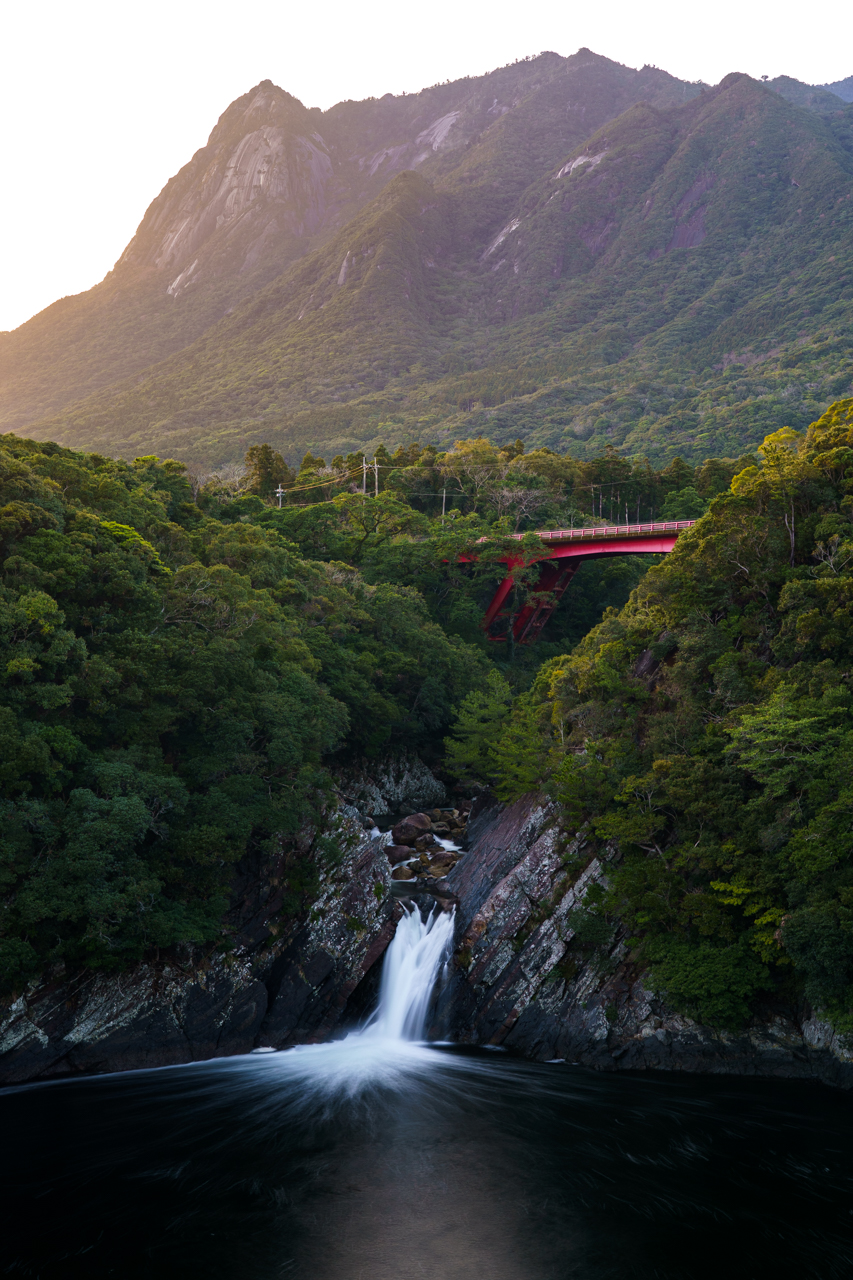
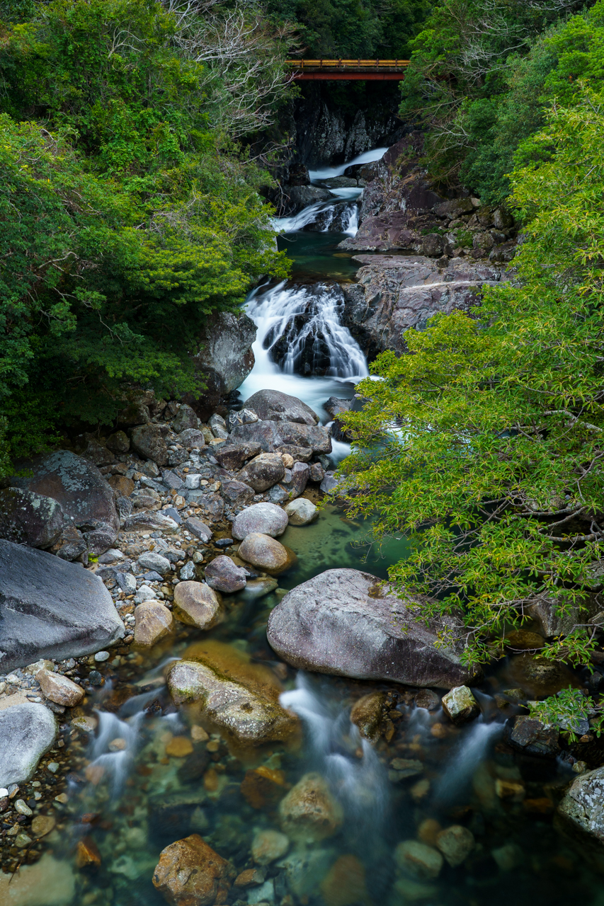
Next I attempted to go to the Yakushima Botanical Research Park, where they have a selection of fruit trees and plants. Unfortunately they were closed for construction; bummer. Instead I parked just a little down the road at the Pontan Hall and walked across the street for the viewpoint of Toroki Falls (トローキの滝). Alone it’s not that impressive of a waterfall, but because of the heavy rainfall the day before, the water had more bubbles in it, which made for a spectacular long exposure photo.
Closeby is Senpiro Falls, which is another magnificent waterfall which I actually visited the day before. There’s actually a path that goes into the valley closer to the waterfall, but due to heavy rains (or maybe the season of the year?) that path was unfortunately closed. Instead I took my time taking more long exposure photos.
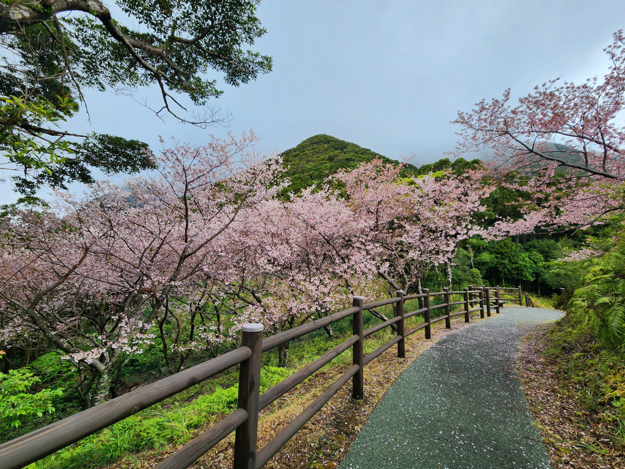
The innkeeper had told me about a secret grove of sakura trees right at the parking lot. Surely enough, past a set of stairs behind the parking lot, there were some lovely trees in full bloom.
At this point I was running out of options to kill time. I wasn’t too keen on the off-chance that the view above could be purely obscured, but I had no other places I was interested in, so I took the plunge into the forest to start my hike.
Mt. Mocchomu
Because I was starting quite late (at around 10:45 AM, just on the brink of getting back before sunset within the 7 hour estimated hike time), I set off at a very rapid pace through the mountains.
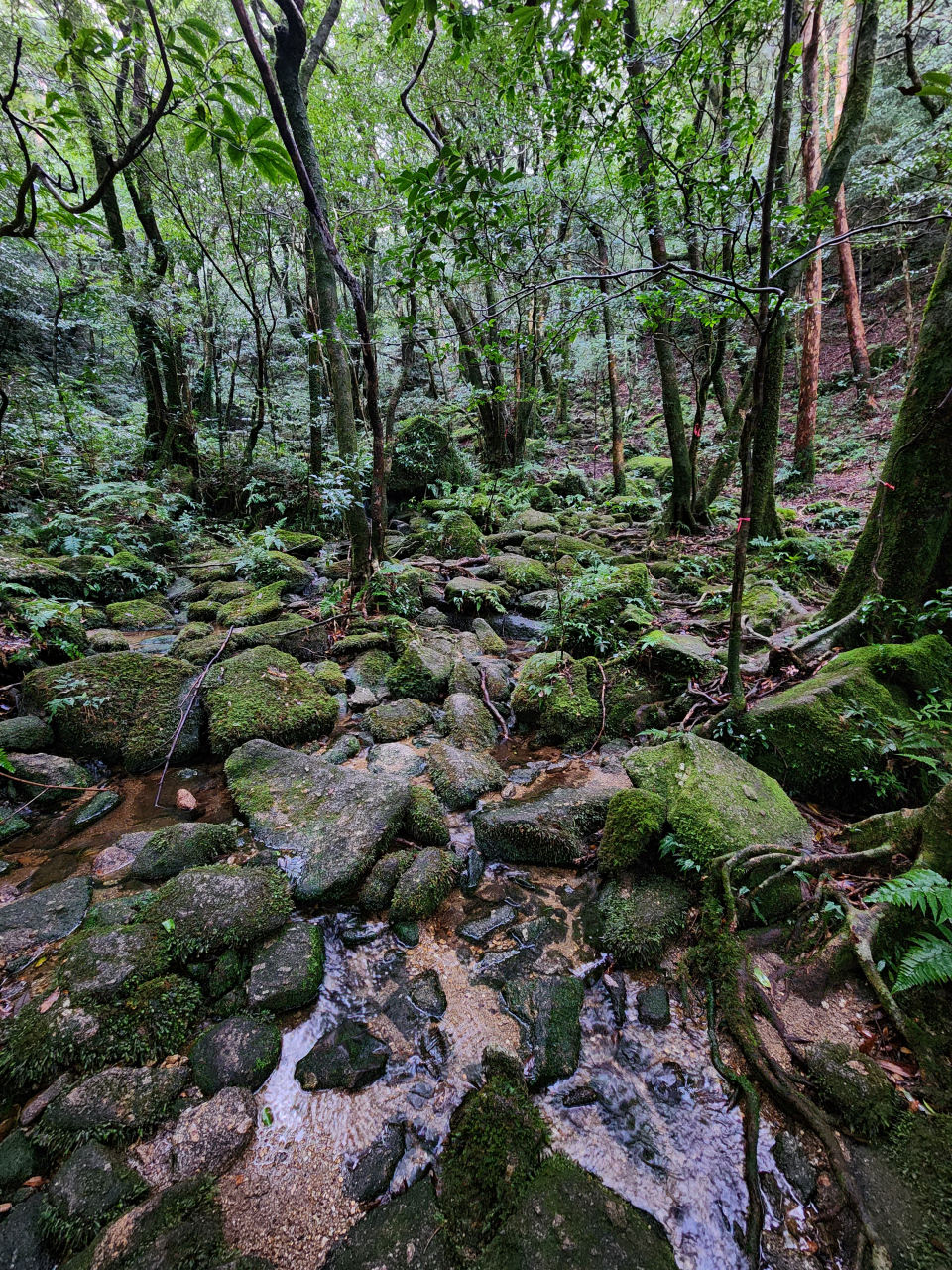
The hike to Mt. Mocchomu feels a lot more “wild,” likely because it’s not as well-known, so the undergrowth and moss is not as eroded here along the trail. Up until now the previous trails have been pretty obvious to follow, but here I needed to pay close attention to the infamous pink tape that marks trails across Japan. In fact, I noticed a lot of newly placed tape and in some areas even laminated signs particularly at curves in the hope of preventing people from getting lost. From the soil erosion patterns it was clear that some people had strayed off the path first before finding their way back, but not everyone is so lucky. This blog post details someone’s account of becoming lost on the mountain.
Nearly an hour into my hike I encountered another large yakusugi, the Bandai Sugi (万代杉).

Every 100 meters or so you pass by an elevation marker. As I progressed further, the forest became shrouded in mist, and the roar of the Senpiro Falls gradually faded away. There were no sounds of cars or people nearby, just the sounds of the forest and myself trampling through the woods.


Near the top, the hike turns into a fun scramble over roots and steep inclines with chains and ropes. I finally met a pair of hikers, who were the only other people I encountered on the entire mountain that day. As to be expected, they said the viewpoint was entirely fogged up. I was almost at the end anyway and continued making my way to the summit.
Finally I reached my goal in a swift 2 hours 15 minutes pace, only to be met by a wonderful view of…nothing. All I could see around me was the giant cloud that I had been walking through. Or at first, anyway. Since it was comfortable in my hiking outfit and not very windy, I ate my lunch bento while scrolling through Reddit on my eSIM data, waiting for the weather forecast to come true.
Not even 20 minutes later did I start seeing the first patches of land through the mist!
It was much easier to see how the clouds moved over the forests behind me.
The mist gradually dissipated after another 50 minutes of cheering and yelling into the void.
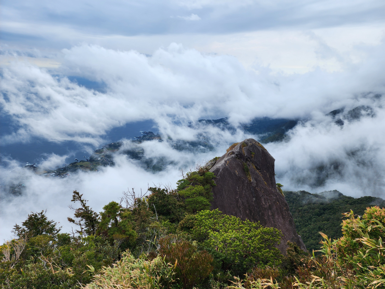
Eventually I could see 270 degrees around myself, save for a portion of mist that continued to hang at the back of the mountain, and the sun gradually broke through the cloud cover. The view was 100% worth the wait and the gamble on the weather forecast!
Supposedly on another side of the summit, there’s a rope that leads down to a small shrine. Since I was alone I didn’t want to risk falling, so I didn’t go looking for it. I wanted to spend more time at the top until the mist was entirely clear, but it was already 3:30 PM, so I started heading back to make sure I was off the mountain before dark.
By the time I returned to the parking lot, the sky and mist had completely cleared up. Realizing that the top of Mt. Mocchomu was now visible from below, I hurried back to Toroki Falls for a last-minute long exposure.
Day 7: Western Yakushima and Return to Kagoshima
Alas my time in Yakushima was coming to an end, and I had to say goodbye to my minshuku. It was quite bittersweet as I had such a fun couple of days.
I took it easy this day by completing the western portion of the ring road around Yakushima. I made a brief stop at the Nakama Banyan (中間ガジュマル) tree before stopping yet again at Ohko Falls for a long-exposure shot.
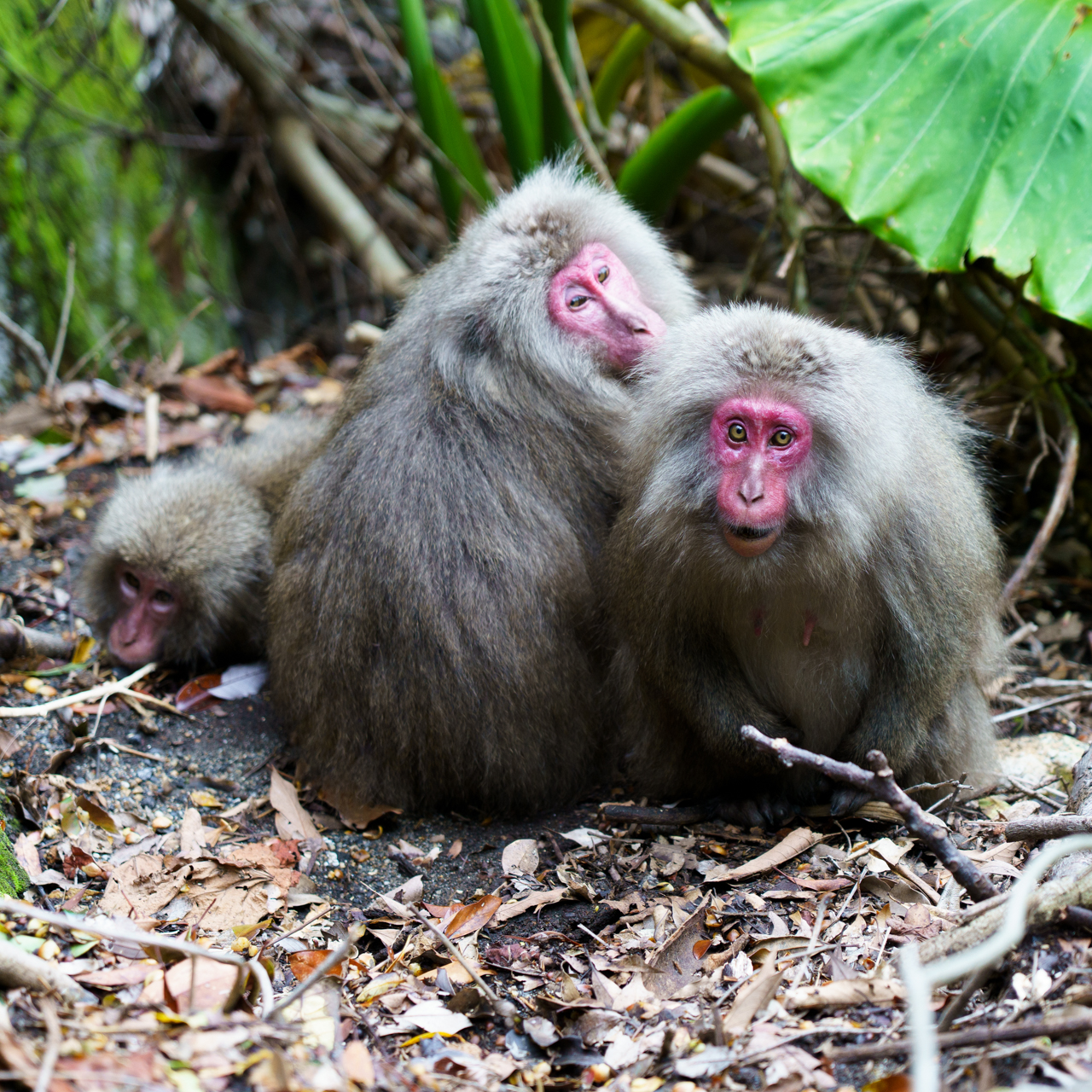
Continuing north, the Seibu Rindo (西部林道), meaning “western forest road,” begins just north of the bridge crossing the Segire River. The Seibu Rindo gets a score of 5/5 in terms of driving difficulty. The roads here are quite narrow and precariously positioned, and there’s no room for error if there’s an oncoming car or bus. There are spaces to pull over to let cars pass, which I had to do several times.
This road is particularly famous for the Yakushima macaques and deer that inhabit this region. It was quite windy, so I think a lot of the animals were sheltered in the forests, but I did catch a glimpse of baby macaques as well.
I’d recommend stopping on the two-lane portions on the southern part of the road if possible, as then cars can pass while observing the wildlife.
Before arriving back in Miyanoura, I stopped at several other locations. I attempted to visit the Yakushima Lighthouse, although due to safety reasons it was closed when I visited. Further northward is Yokko Valley (横河渓谷), which is an idyllic river valley and probably the perfect place to cool down on a hot summer day.
Once arriving in Miyanoura, I hit up two shrines in/near Miyanoura, Yakushima Shrine (屋久島大社) and Yaku Jinja (益救神社), for their goshuin. They have some of the coolest designs so if you are interested I highly recommend stopping by.


Since I thought I had had time to kill, I browsed gifts at the the Yakushima Furusato Ichiba Shima no Megumi-kan (屋久島ふるさと市場島の恵み館) and went to the museum exhibits at the Yakushima Environmental and Cultural Village Center. I realized I was cutting it short on time between refilling on gas, packing my things, and getting to the harbor, and I hurriedly headed back to the rental car shop before grabbing a ride to the harbor. Oops!

As part of my online reservation, I was actually handed a voucher for the return trip back in Kagoshima. This needs to be exchanged for the actual boarding pass at the Miyanoura ferry terminal. Make sure you don’t lose this voucher!
After getting back to Kagoshima, I clumsily used city buses and made my way to my lodging for the night, a Toyoko Inn close to JR Kagoshima Station. This particular location’s Toyoko had new amenities and large rooms. I was quite impressed! I chose this location as it was close to my car rental the following day. I thought about traveling to Kagoshima Airport on the bus and renting from there, but there were no hotels in that area.
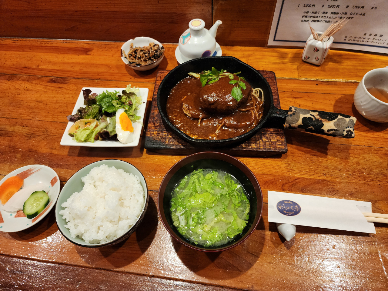
I found a nice teishoku set meal place across the street called Washokutei (わしょく亭). The owner and his wife were super nice and chatty, and he talked about having hiked up to Jomon Sugi and having a picture taken next to it years ago. The price was super reasonable too. It seemed like this place was usually more busy around lunch, as I had the entire place to myself.
And that’s a wrap!
Looking Back
I don’t think I would have changed a thing about my itinerary, and I’m super glad I brought weather-appropriate gear to enjoy the island despite the rain. Definitely plan for flexibility around weather. The car rental from 3/2~3/6 costed me ¥30545 (about $200) and I used ¥2840 (about $20) of gas. I only needed to refill my kei car once I returned to Miyanoura despite climbing up mountain roads and going around the island once. I had way more freedom as well to see and visit places I wanted when I wanted, versus taking a bus. It would have been great to have more chances to try local foods, or try some of the hot springs, or stay even longer—but I’ll save those thoughts for my next trip there when I (hopefully) get a chance to climb Mt. Miyanoura.